Pages

11.28.2010

Shipping Barrels To and From the Caribbean

I never wrote on this blog that we needed to ship back a bunch of stuff once it was time to return to the U.S. from Barbados. I realized that small but significant oversite when I saw this short piece in today's New York Times, "Shipping Christmas to the Caribbean."

Yes, Christmas is pretty huge in Barbados but what is even more huge are the prices of things like laundry detergent, dry cereal, and clothes. Prior to moving to Barbados for the year we were advised to "send a barrel full of stuff because everything is so expensive here." I looked into this but never did happen upon any information about shipping a barrel. All I found was that I could get a portion of a shipping container but that seemed overly large for our needs. I even thought about sending one of our cars over to Barbados, filled with extra "stuff," but worried about getting slammed with a high tariff.

The airlines have made it so that in the year we were away, we could bring home even fewer bags than when we came. We could pay extra for each bag, of course, but it was going to really add up. That is when we got on the stick and found out about shipping a barrel. The only place that does this type of shipping in Barbados is Laparkan whom we bought an empty cardboard drum from (similar to the one in the photo). We took it home and filled it up with 300 pounds of books, long pants, a rip stick and beach towels. Laparkan then came to pick it up and facilitated our shipping the barrel back to New York. We were told it would take about a week. It really took two and a half weeks (not bad) and we had to go down to JFK to pick it up. By the way, our barrel was opened and inspected somewhere along the way, not in Barbados and not in the U.S. but all of our stuff was there, though we had Lego pieces flying everywhere.

If you're moving to the Caribbean, be aware that the prices of all the things you know and love (or at least the things you rely on) are going to be really high. If you're in the New York area, check out this Times article for some advice on who ships barrels to which countries.

10.31.2010

Severe Storm in Barbados

I heard that tropical Storm Tomas hit Barbados pretty hard on Saturday October 30. It struck at 6 am so, fortunately, there were few people on the roads driving to work and school. I also hear that there were, thankfully, no fatalities. These two videos not only show the severity of the storm but also show where I used to live. I drove along this road - the Coast Road on the west coast in St. James parish - everyday.


This one shows the same route only driving south on the coast road, going towards Bridgetown.

I hope everyone is doing okay there in Barbados and that the recovery is quick.

10.25.2010

Getting Back to the U.S. - Clearing Up Mail Forwarding

I got back to the U.S. August 16 after living in Barbados for nearly a full year. I've needed to write this short update to express some frustrations with the U.S. Postal Service upon my return.

Oddly enough, it was easy to forward my family's mail down to Barbados but going in the reverse took months to rectify; we started receiving mail addressed to our Poughkeepsie adress on October 11. In my mind it was a simple "Turn off the Forward" that should have been easily handled at some sorting center somewhere in my county. I'm including here that the problem, in the U.S. Postal Service's eyes, stems from receiving mail from an adress abroad...note the "We don't handle from foreign addresses" written in under Other. Sheesh! How U.S.-centric can we get!

I was so frustrated with the situation of multiple phones calls and run-around and finger pointing - "It's not MY job" - that I contacted my local state representative. It's an election year, so why not? The assistant to the Senator told me she made a call and got the same crazy run-around that I got and said, ultimately, that because the U.S. Postal Service is a Federally-run entity, I should contact my U.S. Senator. Oy!

I'm not one of those "take your hands off my money" kinds of people and I agree with paying taxes for services for the public good. A functioning mail service is a public good. Our U.S. Postal Service is not, at present, a well-oiled machine.

Funny. I went to a small island nation in the Caribbean and had no problem with my mail getting to me.

9.19.2010

Coming Home - Making a New Normal

I've been back in Poughkeepsie, New York, for a month. Hard to believe. There’s still stuff to unpack from our year in Barbados.

Yesterday I received an email from a friend/ colleague/ mentor and in it she said "How're things back in New York? Transitioning back to the old normal can be difficult (so we make new normals)."

This resonated with me and moved me to write as this weekend (starting Friday evening) was Yom Kippur – the Day of Atonement – and the start of the Jewish New Year. At the Saturday morning service I sat and listened to the rabbi’s sermon. He started by talking about the idea of resurrection, a foreign concept in Reformed Judaism, but something that was part of early Judaism and still believed by Orthodox Jews. In discussing resurrection, the rabbi said that he felt that one's dying and returning could be looked at more of a metaphor. He thought of it more to mean rebirth, or in my mind renewal, that we may or may not come back from the dead. Who knows? Who among us has seen Moses or Abraham Lincoln? (Though some have claimed to have seen Elvis.) Rabbi said that when we feel we have hit a road block or come to the end of a long road or when we feel the most lost, there will be something that turns it around, we're shown a new road, a new door opens, there's a clearing in the forest. So rather than the literal interpretation of resurrection, he gave us something akin to resurrecting a life, a new beginning a new normal.

Barbados, for me was a glorious journey that fulfilled me beyond measure. After a long spate of personal and professional trials, I was presented with Barbados where my family and I flourished. How could I go back to New York after such an amazing year abroad? They say you can never go back. But it is just not true. Sometimes, you have to go back. And who could not wish to return to the beauty that is found within the Hudson Valley in autumn? The weather is now turning cool and crisp, the leaves are just beginning to change. I love this season. My house is spacious and welcoming. I see neighbors on the street who stop and ask how my year was. They missed me. They missed my family. I am home. You can go back.

For the first time in my life, I do not have a clear plan. Since I was a teenager, I’ve known, career-wise, what I was going to do. I came back home to New York following a terrific Fulbright experience without a paying job, but I am more clear-eyed than ever. I am taking a sabbatical. I am resting. I am excited about the present moment picking my kids up from school, moving back into our house, supporting my partner as she goes back to work, and planting my feet back into my Poughkeepsie community. This is my new normal, a new beginning. What the future holds is still to be determined.

To a sweet, happy, good new year, L’shana Tova!

Photo of the Hudson Valley is from Flickr Creative Commons taken by b.reynolds.

8.13.2010

Last Day of My Fulbright

I had my last day of my Fulbright fellowship at CERMES and the University of the West Indies last Friday. I probably should have posted this earlier in the week but here it is. Short and sweet.

This year has been a gift to me. I have had a golden opportunity to spread my wings and take flight and I have had encouragement and a stable base to do so. Sure, I contributed some of my expertise to a few projects. But I gained so much more than I gave. Last Friday the department gave me a coffee, tea, and banana bread party send-off. It wasn't until a little later when I got in my car to drive home that I cried. I cried nearly the entire way home. What a joy to weep about missing a place that embraced me in such a short period of time.

The first project I worked on I did some final edits and additions. You may recall that work was a Google Earth project based on data from the Grenadines. Here is the MarSIS project site. Here is the project KML (will open in Google Earth). Take a look. It came out great, I think. But would love your feedback if the user experience is less than satisfying.

The second project was to organize the CERMES GIS data library. There were already some geodata up on the CERMES server but I just added some more data, organized by country and region, and set up a template for future data to be added. I hope this helps the students out. I'm not a librarian. I should try to go back and get an MLS degree if I really wanted to be an effective GIS consultant, but I don't think I have the time. I really do admire librarians, though.

This week has been spent packing and reflecting and filled with lasts...last full moon, last flying fish sandwich, last Magnum bar, last trip to Animal Flower Cave...our flight back home is Monday. Back to New York. Back to reality.

8.09.2010

Monday Night at Ju Ju's Beach Bar and Restaurant

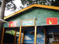
There's a great restaurant just a short walk or swim from our apartment. It's called Ju Ju's Beach Bar. It's a little tucked away and hard to find so I wanted to make sure to sing its praises.

Ju Ju's is owned and operated by Joanna. She and her skilled chef serve up fresh fish of all sorts (flying fish, dolphin, snapper, whatever is in season and fresh) grilled or fried. Very tasty. The kids like the chips (also known as "fries"), hamburgers (the meat-eater anyway) and the cheese sandwich. The flying fish sandwich is great too. The prices are very reasonable given the high-end location on the west coast.

You don't have to wait for Monday. Ju Ju's is open everyday but closes by about 7 p.m.

Where is Ju Ju's?

Latitude: 13°12'16.83"N, Longitude: 59°38'24.63"W

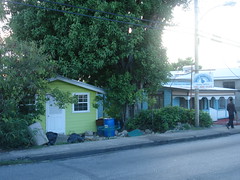
Located directly off the Coast Road in St. James, Ju Ju's Beach Bar is just south of the Lone Star Restaurant. It is seaside. Look for the lime green house and the sign that says "Dive Barbados" (both shown in the photo to the left) and follow the walking path to the left of the green house. There is no sign for Ju Ju's. Watch the video below to get an idea how to get down to the restaurant and see what it looks like.

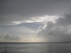
But not only do you get delicious Bajan seafood, you cannot beat the location and view of the sea. This was from the beach at Ju Ju's taken in May.


And this was taken tonight.


The photos can be found on my Flickr page and the video is on my YouTube page.

8.05.2010

Things We Should Adopt in the U.S. #4: Traffic Circles or Roundabouts

By whichever name you choose to call them, traffic circles do their jobs well - keeping vehicles moving along the roadways. Here in Barbados roundabouts are employed all around the island, on small roads, in the city, and on major highways. The cars roll on. I'm not saying that there are no accidents here, but I don't see fender benders resulting from navigating the roundabouts.

Barbados was colonized by the British and their influence can be seen in many arenas in Bajan society - the traffic circle is but one of the marks the English left here. Because of living in Barbados (as well as in Trinidad where they also have roundabouts) we could easily adapt to traffic circles when we took our U.K. trip last month.

I write this post because of past experiences with a traffic circle controversy that occurred in my neighborhood in Poughkeepsie. Some community members wanted roundabouts put into a busy, too-fast roadway and some others thought these traffic devices would be a menace by diverting all vehicles to their street causing snarls in front of their homes. It pitted neighbor versus neighbor. I wish I could pull up a couple of letters-to-the-editor from the local newspaper but they are archived and not free. Well, the traffic circles went in, as well as some traffic-slowing devices on the other street, and all is well in Poughkeepsie. To think, if everyone could have just experienced the joys of roundabouts first hand by driving through them in Barbados or the U.K., we could have avoided all that angst.

Here, take a look for yourself:


The Creative Commons photo of the roundabout above was taken in England and was found on ztephen's Flickr page. The video I skillfully took while driving around a traffic circle near Dover Beach in the southern part of Barbados. I was very careful. Note the coconut sellers on the left towards the end of the video. You don't see that in Poughkeepsie!

8.04.2010

Turtle Beach

We moved temporarily to Barbados on September 1 last year. The apartment is nearly right on the beach. We feel very fortunate. It took me awhile to realize that not only do we have access to one of the most beautiful beaches on the island with swimming in Caribbean blue water but we have turtles.

In the first month we would snorkel and see what looked like discarded ping pong balls strewn across the reef that is our backyard. We'd pick them up underwater, bring them to fresh air and realize that these were not athletic equipment but some sort of egg. Then we went on a turtle patrol walk along the south coast of the island. We saw hundreds of baby turtles and one turtle track. Still, I did not think of our beach as a turtle nesting beach. Plus, I knew what a marine turtle track looked like because we became fascinated with Leatherback turtles in Trinidad a few years prior. It was not until November when turtle hatchlings came scurrying up from the sand on our beach that I understood the magic that we have on this beach. They've been here nearly the whole time. Certainly we see sea turtles when we are snorkeling but they've been nesting and hatching throughout most of our time here.

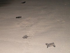
Yesterday when I went for a morning run I saw eleven turtle tracks along my usual route. That was more than usual. Today I saw just two, but the point is there are tracks and nests every morning. Here are two from a couple of weeks ago.

When you come to Barbados, wake up early and take a walk along the beach and you will see the tracks. Most beaches enjoy frequent visits from nesting turtles, I'd say from May to October. It's best not to walk up to a nesting turtle, shine a flash light (or torch) on her, or scare her in anyway. If you see hatchlings, feel lucky! But let them make the journey to the sea on their own; don't help them, they need to feel the sand and stretch their legs because they have their work cut out for them.

These turtle shots are from my Flickr account.

7.26.2010

"If Ya Bajan and Ya Love Ya Teacher, Raise Ya Hands!": Junior Kadooment

For the past few months the Barbadian radio stations have been playing an endless rotation of soca music (hear it in the videos below) all in the run-up to Crop Over. Crop Over happens August 2 this year and is so named for the end of the sugar cane season.

Saturday was Junior "Kiddie" Kadooment and was a miniature version of what we might expect on August 2, only without all the alcohol and bacchanal. This was such a sweet affair that I'm really glad I went and took the kids and I'm glad I got lots of video of the little paraders.

We met up at the beginning of the parade route and watched the marchers make their way to the National Stadium where the various "bands" of kids parade across the stage in front of the judges. The title of this post is a reference to something the M.C. said from the stage. There's a lot of emphasis on and value placed in education and teachers are very well-regarded in Barbados. Yet another thing we should adopt in the U.S.!

The photo of the little reveler is by Risee on Flickr and not by me. I had yet another camera failure and did not get still photos of the kiddie kadooment.

But I did get plenty plenty video of the young paraders. Check it out, but be cautious, it's a little loud:


The event that followed the parade was a Junior Calypsonian competition that, unfortunately, we could not stay for. One of the opening acts for the the show was a young soca group (the Hypa Kidz) that has a song out this Crop Over season called "Happy Feet." You can hear "Happy Feet" in the first video with the little parade marchers. Here is Hypa Kidz' performance:

7.22.2010

Hawksbill Turtle Tracks


School is out for the summer and now we find ourselves heading down to the beach a little earlier in the day. This video was taken at about 7 am yesterday. I went out for my run in the morning and saw a lot of Hawksbill turtle tracks and nests but these two were right in our back yard. I had to bring the kids down to see them.

I love living here. We're going to miss it.

7.08.2010

Return Home, Reflections on Trip

Latitude: 51°10'11.98"N; Longitude: 0°10'21.42"W

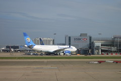
We had a L O N G drive to the hotel (Corner House Hotel in Horley) which is very close to Gatwick Airport. We kept is lively with The Mists of Avalon. But it was still a little too long for all of our tastes. Though the scenery has been remarkable for most of the trip, the highway (I believe it was the A1(M)) south towards London is less than lovely. Gatwick Airport is still south of London and not really in London. We never saw London on this trip. It's for another time.

Latitude: 51° 9'1.57"N; Longitude: 0°10'35.95"W

We dropped off our rental car (or would that be a 'hire car'?) at Hertz and then went into Gatwick to wait for the flight. What a wonderful trip we all had. There were so many cute towns and sweet places to see. The countryside is so pastoral. Parts of it, with the rolling green hills and grazing bovine, looking strikingly like...New England. Imagine! The history of the UK is incredible, from the Romans to the Vikings and the Normans. Catholicism, Christianity, paganism. The castles and cathedrals, royalty and the commoners, or I mean everybody else. Just driving around and getting out at places along the way reveal the long history of being conquered and a history of conquering and creating the British Empire. It's all so fascinating to someone from the U.S., where our history of colonialism started in the 1600's, we have no real royals (except for maybe our super wealthy) and we are a much larger, geographically speaking.

The trip was a great way to celebrate the end of the school term for the kids and the wrapping up of the Fulbright and sabbatical work for us. If I could shell out some advice...got your kids a passport and take them places, early and often.

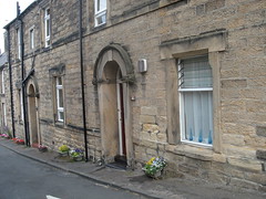
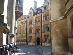
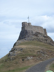
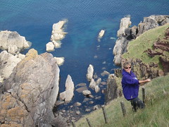
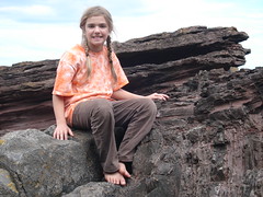
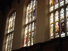
The photo at top is from Alnmouth, England, the second photo is from Cambridge, England, and the last photo was taken in Edinburgh, Scotland. These photos and more from the trip are located on my Flickr page.

7.06.2010

Holy Island (Lindisfarne) England

Latitude: 55°40'8.49"N, Longitude: 1°47'5.01"W

We made the pilgrimage to the Holy Isle in northern England. Lindisfarne is another name for the Holy Island. Along the way on this trip we've been listening to The Mist of Avalon on an MP3 player piped through the radio, this is to get us in the spirit of Olde England in the times of King Arthur and the priestesses and the druids. Marion Zimmer Bradley invokes the Holy Isle of the Christian priests and the Lady of the Lake, shrouded in mist, next the Holy Isle. I am still not sure if the Holy Island is thee Holy Isle of the The Mists, but I like to think there is some pagan blood and sweat in the ground here. Now, it seems, the property is for sale.

To get out to the island, one must wait for the tide to recede, to leave, you must be mindful of the rising tide. The castle shown at the right is an Elizabethan fort that protected the Holy Island harbor. Building on the castle began in 1570 and was used as a fort for over 300 years. It has been privately owned for about 100 years.

Latitude: 55°40'9.44"N, Longitude: 1°48'3.33"W

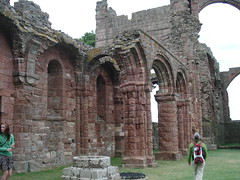
The village is the site of the lovely Lindisfarne Prior, one of the most important centers of British Christianity. The Priory was founded in AD 635 and is the site of St. Cuthbert's remains. The ruins are beautiful, with large stone arches of weathered red sandstone and preserved building spaces showing the monks housing quarters for when the site used to be a monastery. There is still an active church right next to the Priory because there are about 200 people who live in the Holy Island.

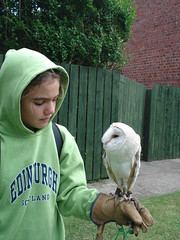
We got to see an interesting raptor display on Holy Island. Given by raptor rescue people, apparently owls have been purchased in abundance following all the Harry Potter joy. Well, people, you cannot keep an owl in a little cage, like Harry does, and expect it to be very pleased. The kids liked getting to hold an owl and a hawk and now hope to volunteer at the local Raptor Center back home when we get back to the U.S.

For dinner we ate in a pub. I had Shepard's Pie and a pint. One odd thing, though, we couldn't find a place to eat at 5:30 pm and had to wait until dinner was served locally at 6 pm. This is a phenomenon we encountered at that time in most places around the UK. It wasn't a big huge deal but we did not want to get caught trying to get back to Alnmouth at high tide. No worries. We made it.

These photos and more from the trip are located on my Flickr page.

7.05.2010

Seahouses and the Farne Islands, England

Latitude: 55°34'58.30"N, Longitude: 1°39'9.06"W

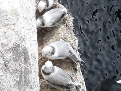
We drove from Alnmouth north to a town called Seahouses. From here we caught a boat (the Serenity II, if you go, look for this tour operator) out to the Farne Islands to see the puffins. That was the plan. We ended up seeing so much more. Yes, we saw puffins, Eiders, shags, terns, razorbills, guillemots, and gulls on the shores. We also saw sea lions and loads of jelly fish. We got out and walked around for an hour on a National Trust site on Inner Farne and saw the nesting birds very up close. Sometimes up too close as the parent birds, protective of their young or their eggs would swoop very near our heads, shewing us onward and away. It was fun though. Gulls make their nests right on the edge of a cliff. Puffins make a burrow for their eggs and hatchlings.

We also saw St. Cuthbert's Chapel on Inner Farne. Cuthbert figures prominently in the Christian history of northern England so it was interesting to see this sweet little chapel on this rugged, bird-filled rock island.

These photos and more from the trip are located on my Flickr page.


Added July 22, 2010. My daughter made a video of her birding experience on the Inner Farne. Here's her YouTube channel.

7.04.2010

Alnmouth and Alnwick in England

Latitude: 55°23'25.85"N, Longitude: 1°36'51.26"W

We are staying in Alnmouth very close to Alnwick, England. This is another self-catering place (Midwood Lodge) and it seems brand new. Our luck! The owner left a bottle of wine, some lemon cake and cookies to welcome us.

Latitude: 55°24'55.50"N, Longitude: 1°42'21.12"W

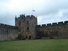
We went to Alnwick Castle this morning. This castle was on our plans at the outset of the trip. It was billed to us as the "Harry Potter" castle. I imagined the castle of the large spires and rustic setting next to a lake. This is not that one. I think that castle is in Romania somewhere. This castle was okay. The first two Harry Potter films had some filming done on the grounds of the castle. I think that scene where Harry learns how to ride the broom is in the bailey. But still, I don’t have many castles in my American life and any castle provides some intrigue. This castle has been in the Percy family since the 1300's. Yes, they are royalty and no, no other people but the Percy's will ever be able to own or live in this castle and this concept is difficult for an American to take on. Happy Fourth of July, by the way. This is a unique castle in that it is or was both a castle (an armament) and a palace (the place where the duke and duchess lived). The current residents live there in the "off season" after the tourists are no longer allowed to see the place. When they come to live in the castle, they actually use the space; their pictures are all over the place. It was kind of creepy. And when they come to Alnwick, they hunt ground birds. No, that is not a life I am familiar with.

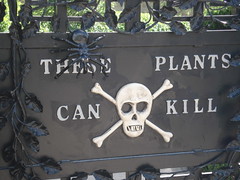
Alnwick Gardens, close to the Castle, were beautiful. The kids really liked the maze made of bamboo. I find those scary and claustrophobia-inducing. The perennial garden and rose garden were stunning. Be sure to go through the poisonous plants walk and see all the medicinal plants that are used for all sorts of cures and that the pharmaceutical industry wants to now label as "dangerous." There was even cannabis in the garden.

These photos and more from the trip are located on my Flickr page.

7.03.2010

Siccar Point in Scotland

Latitude: 55°55'46.36"N, Longitude: 2°18'2.08"W

We left Edinburgh and drove east to find more connections to James Hutton. We made our way to Siccar Point in Scotland and found a couple of placards, one reading that Siccar Point is "arguably the most important geological site in the world." It was breathtaking. This is the location that Hutton came up with the idea of an angular unconformity (see the picture below)- that much time passed between two very different rock formations and that earth is older than 6,000 years. Much older. Getting down to see and walk on the outcrop was tricky but worth it.

By the way, if you want to view Siccar Point from the aerial view (using the location above), don't use Google Earth as the aerial photography for this coastal location is oddly obscured and out-of-date. Use Bing Maps.

We hit a couple more Hutton-significant locations along the way. But I really liked stopping and picking strawberries. We picked so many strawberries that we went a little crazy. But they tasted amazing.

These photos and more from the trip are located on my Flickr page.

7.02.2010

Beautiful Edinburgh, Scotland

Latitude: 55°56'59.46"N, Longitude: 3°11'39.66"W

Like all of our accommodations, we found this self-catering apartment (Capital View Apartment) on the internet and made the arrangements before we left. It was in a perfect location for seeing Edinburgh, right next to the Royal Mile.

Latitude: 55°56'56.17"N, Longitude: 3°11'40.75"W

We had breakfast (and then lunch because we liked is so much) at a renovated and re-purposed cathedral, now called the HUB. In addition to food, they have performances at the HUB and the Edinburgh Festival.

Latitude: 55°56'54.92"N, Longitude: 3°11'53.76"W

After breakfast, we walked up the hill to the Edinburgh Castle. This place was packed and was almost a little like Disneyland, but ended up being worth it. The cost to enter was $20 USD per adult. The views from this armament, located on a huge, tall piece of rock in the middle of Edinburgh, were well worth it. You can see the Firth of Forth, Arthur's Seat (has nothing to do with THAT Arthur) and another castle/abbey ruin on another hill. We were fortunate to have a beautiful and clear day.

Latitude: 55°56'47.07"N, Longitude: 3°10'27.08"W

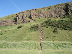
Then we went on a James Hutton quest. James Hutton, a native of Edinburgh, was the father of the science of geology. We visited his birthplace, a memorial and a monument in his honor. We walked along the Salisbury Crag (we are the specks on the picture to the right climbing up the trail) near Arthur’s Seat and saw the contact between an igneous sill that intruded into a sedimentary rock formation. This is a walk young Hutton must have made many times as he pondered the age of the earth and how it formed.

Latitude: 55° 56′ 48″ N, Longitude: 3° 11′ 32″ W

We also visited James Hutton’s grave at Greyfriar’s Cemetery. His headstone was locked away in a part of the cemetery not open to all but that didn’t mean it was in some cared for condition. No, it was difficult to even see his headstone without the help of the person working there. One added bonus to going to this cemetery has a Harry Potter aspect to it. Not far away from the cemetery was the café in which J.K. Rowling wrote the first Harry Potter book. The café is called Elephant House. We had to eat there, as we are all major Potter fans. But this cemetery must have been the location of some reflection and inspiration for Ms Rowling in addition to her long-milked coffee at the café. We saw the headstones labeled with the last names Moodie, McGonagall, Black (this one was Josephus), and Thomas Riddell. From inside Elephant House, Ms Rowling would have looked out the window to see Greyfriar’s.


Edinburgh is a beautiful and terrific city. It reminds me of San Francisco with its hills, youthfulness and loads of things to do. I was wish we had a little longer to explore.

These photos and more from the trip are located on my Flickr page.

7.01.2010

Hadrian's Wall

Latitude: 55° 1'33.72"N, Longitude: 2° 8'23.24"W

We drove north towards Edinburgh today. Along the way we stopped to see Hadrian’s Wall at Chester’s Roman Fort near Walwick, England. Hadrian’s Wall was built during Roman rule – about 22 AD to 306 AD – and much like the Great Wall of China, this wall was meant to keep out northern marauders from infiltrating Roman Britain. Much of Hadrian’s Wall has crumbled away or was re-purposed for newer walls and stone structures. Add to that the fact that there’s a large build up of soil, Hadrian’s Wall would require a true excavation to unearth all the finials, tombstones, alters, and other clay , stone and metal artifacts. There is a museum at Chester’s Roman Fort that has many of these types of findings. In addition, there is a well documented excavation of a Roman fort. These forts were built about every mile along the Wall and within the fort housed a troop of soldiers, horses, cooks and commanders. Hadrian’s Wall is over 70 miles long.
This was a great stop along the trip.

Zoom to the location (given above) in Google Earth. The aerial view is striking. Turn on the Panoramio photos for the on-the-ground view.

These photos and more from the trip are located on my Flickr page.

6.30.2010

More York - Minster, Clifford's Tower, and Jorvik Vikings

Latitude: 53° 57′ 43″N, Longitude: 1° 4′ 55″W

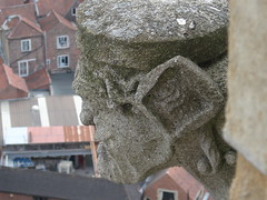
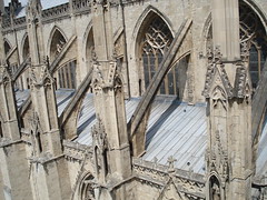
We woke up early to get a start on what was to be a long day. All days are long on this trip, with the light of day lasting from 5 in the morning (at least) to well over 9 pm, there’s no excuse for not seeing everything. This morning, we climbed to the top of York Minster...273 steps (Tillie counted) and much huffing and puffing later we had an awesome view of the beautiful city of York. The building tops reflect the red brick used in all local buildings. We got up close with gargoyles and saw the fabulous flying buttresses designed to keep propped up the long, narrow and yet extremely tall cathedral that is the Minster. If you go to York, don’t miss climbing to the top of the Minster.

Once back down on ground level, we took our time in the cathedral. We didn’t have time yesterday to explore the Minster. The stained glass windows are extraordinary. The Great East Window, which is over 70 feet tall and contains the largest area of medieval stained glass in a single window, was undergoing renovation. This turned out to be our good fortune as we got to see some of the panes up close, and in place of the Great East Window was what was billed as the largest digital poster anywhere. I don’t know about all that, but it made for a great display that provided a history of what each of the panels represented. This information would not otherwise have been displayed. The East Window gives the biblical history from the Old Testament to the New Testament. They had on display stained glass panels that were yet to be renovated and another that was in perfect shape. It was a very informative display.

Next, we walked south and east to The Shambles. This is a lovely little street but not that remarkable compared to other lovely little streets that one can observe (as we have) all over England. Anyway, amble through The Shambles as you make your way to other points of interest in York.

Latitude: 53°57'20.91"N, Longitude: 1° 4'48.00"W

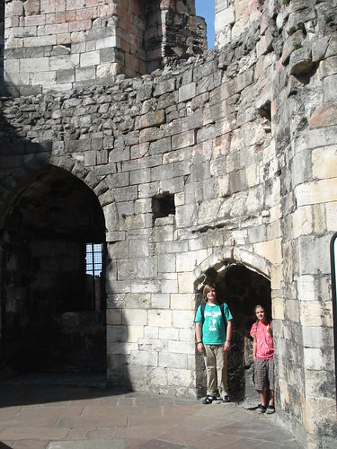
We went to Cliffords Tower. This is a strange and small remnant of a large castle at the top of a hill. It is also the site of a siege upon York’s Jews in 1190. A lot seemed to happen in England during the Norman Conquest around 1066 and the flushing out of Jews was one of them. Why must history continue to repeat? Anyway, Cliffords Tower is worth a visit because it is a true shambles. It is fairly well crumbling down, though one must pay to enter the structure. The tower that remains was once part of an enormous castle built by Henry III. One thing I’ve learned is that castles were for armament and protection, palaces were where the nobles lived and the cathedrals were places of worship and teaching of Christian scriptures. Cliffords Tower was a castle, an armament. The Minster is a cathedral. It is in beautiful shape and continues to be a place where regular services occur. It struck me as odd that the castle is allowed to crumble down and yet the Minster is undergoing near constant renovations as is needed for a place built on this spot nearly 2,000 years ago and in this stone building form nearly 1,000 years ago.

Latitude: 53°57'26.49"N, Longitude: 1° 4'48.67"W

A feature we included as a late minute addition was the Jorvik Viking Center. This place was great. It is an excavation on this site in York showing mostly Viking remains but also some Roman artifacts. This was a very interactive and informative exhibit. The kids loved it and especially liked the ride through a mock Viking village (complete with real smells of the olden days…eew) and docents who really know their Viking stuff. Either they were archaeologists or enthusiasts but we learned a ton about the fair-haired Norse-folk.

These photos and more from the trip are located on my Flickr page.

6.29.2010

York, England

The drive up to York took a bit longer than we expected. We ran into a huge traffic jam but because we took the GPS (with pre-purchased maps for the UK), we were able to confidently go off the main route and find back roads to get north to our destination. We didn't arrive until 4 pm. It stays light out until 10 pm so we had a few hours to see what we could see. There's a lot!

York is a walled city that has changed hands several times from Romans to Vikings and who knows what. Driving into York you can see the walls as well as the Bars or archways through the wall.

We strolled from our hotel (the Churchill Hotel at Latitude: 53°57'54.88"N; Longitude: 1° 5'23.95"W) towards York and the York Minster with a stop along the way through the York Museum Garden. We saw this old ruin of St Mary's Abbey (first photo above) that Kind Henry VIII allowed to fall into disrepair. There is also a remnant of the original Roman Wall within the Museum grounds, called Multangular Tower (to the right).

Latitude: 53° 57′ 43″ N, Longitude: 1° 4′ 55″ W

We took a stop into the York Minster to listen to Evensong, but we instead heard the Solemn Eucharist in honor of St. Peter, the patron saint of the Minster. The boys (and men's) choir sang. It was lovely.

Then we took a walk along the top of the wall. It seems the York wall is called the Roman Wall but, in fact, it is more aptly named the Norman wall. The Roman Wall was smaller and rectangular. There is now (actually, since about the 1200s) a more circular wall around York that stretches out from the various Bars or entryways into the city. We didn't even know we could walk along the top of the wall, so this was a nice surprise. The kids loved it. From this shot you can see the major slope built to detract marauders from attacking York.

These photos and more from the trip are located on my Flickr page.

6.28.2010

Cambridge, England

Latitude: 51° 9'1.57"N; Longitude: 0°10'35.95"W

We flew into London Gatwick Airport and drove straightaway north to Cambridge. We checked into the Cambridge Holiday Inn Express (Latitude: 52°11'36.61"N; Longitude: 0°10'29.56"E) for a ten minute drive into town. Cambridge was so beautiful with every turn a lovely street scene or a window flower box or an outdoor cafe.


What was especially wonderful about Cambridge was to see all of the colleges that comprise the university. The college system of Yale and Harvard is modeled after Cambridge and Oxford, where a student is associated with a college, living there while she or he attends classes at the university, eating meals and attending faith services. The chapels, libraries, central quadrangles, and gardens are amazing. The chapel for Trinity College (above) was lovely and there was a student practicing when we walked in. Isaac Newton, Francis Bacon and Alfred Tennyson lived in Trinity College. The chapel at Kings College was awe-inspiring from the outside but was not open when we arrived. We saw entry-ways to the Master Houses and felt envious as the House Fellow accommodations at Vassar are not quite up to that caliber. The city of Cambridge is a true academic Disneyland.


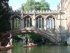
We ended the day punting on the Cam River. Punting is when you use a long stick or pole to push a flat-bottomed boat along the river. We hired someone to punt but you can also rent (or let) a boat and go on your own. I don't recommend it because most of those self-punters didn't have any idea of how to make the boat go straight. Plus, our punt driver had some very interesting things to say about the history of Cambridge.

These photos and more are located on my Flickr page.

6.27.2010

Next Trip...United Kingdom

We're headed out this afternoon: destination London Gatwick Airport. We'll be in the UK for ten days on sort of a whirlwind semi-work-related family holiday. First, we go to Cambridge, then York, then up to Edinburgh, and then to Alnwick. Lot's of plans of things to see and do along the way. I hope to blog each day with the full scoop.

CC photo by Demetrio Neri 1959.


For the fun of it, I made a video of all of us as we were heading out from Grantley Adams Airport in Barbados...what did we hope to see and do?

6.18.2010

Technology Workshops This Week - At UWI

I am an instructional technologist. When I first got to the University of the West Indies, I tracked down my cohort here, Pat Atherley, to see what the system was like at the UWI and to figure out how we could work together. This week we got to do that.

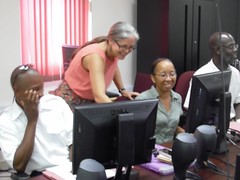
Pat organized a week of Moodle training sessions for faculty members on campus. From beginning-level to advanced, Pat showed all of us (me included - I don't know how to use the Learning Management System Moodle) many of the tips and short cuts to getting course materials up online. How I was involved was Pat asked if I'd like to give a demonstration or two on some of the educational technologies that I know. I happily volunteered to talk about Google Earth (Monday), collaborative writing with Google Docs (Wednesday), and using tablet PCs in teaching courses inside the classroom and out in the field. The photo at the top shows Pat (on right) and me talking about tablet PCs. Both photos here can be found on my Flickr photostream.

The Google Earth session was developed as a hands-on workshop so that faculty members could learn how to create Google Earth files so they can use the geo-browser while lecturing in class. The Google Docs session (also hands-on) went over not only collaborating in a Google Doc (if you don't know, it is just like Microsoft Word only on-line), but I showed the group how to use and collaborate with Google Spreadsheets, Drawings, Presentations, and Forms. The tablet PC talk was really mostly me talking about how one can use a tablet PC for lecturing, sharing slides and PDFs, and facing the students while drawing on the "virtual chalkboard" which is the tablet's screen. I also talked about how tablets are useful for field classes and data collection. Here are my slides for the tablet PC talk.
It was very satisfying to be able to share some of the things I know about teaching and learning with technologies. Thanks, Pat, for asking me to contribute!